
Interactive map
Galápagos Islands map
Every island, visitor site, dive site and airport you can reach on a private yacht charter, on one map. Tap any point to see what you will find there and which pages tell you more.
- 30 places on the map
- 59 visitor and dive sites
- 2 airports with flights from the mainland
- 4 regions, from Genovesa to Española
Explore
Choose a point, discover a place
Swipe to explore the map
All the places
Every point on the map, region by region
The same places as on the map, with every visitor site and the activities you can do there.
Northern islands
Genovesa 2 visitor sites
A horseshoe-shaped caldera in the far north-east and one of the great seabird colonies of the islands: red-footed boobies, frigatebirds and short-eared owls.
- Darwin Bay The only sandy beach inside Genovesa's caldera, among great frigatebirds puffing their red pouches and red-footed boobies nesting in the mangroves. Walk · Snorkelling
- El Barranco (Prince Philip's Steps) A stairway cut into the rock leads to a plateau of frigatebirds, storm petrels and Nazca boobies, where short-eared owls hunt. Walk
Marchena 2 visitor sites
One of the least visited islands, reached only by a few yachts on north-western routes, with clear water and almost untouched shores.
- Mejía Point A remote site on Marchena, one of the least visited islands, with lava shores, sea lions and snorkelling over clear rocky reefs. Panga ride · Snorkelling
- Black Beach A dark volcanic beach on Marchena, far from the usual routes, with seabirds and sea lions. Walk · Snorkelling
Darwin Island Dive site
The northernmost island, about 150 km beyond Isabela, visited only by dive liveaboards. For experienced divers comfortable with currents.
- The Pillars (former Darwin's Arch) Hammerhead schools, silky sharks and, from June to November, whale sharks around the two rock pillars left after the arch collapsed in 2021. Diving
Wolf Island Dive site
Darwin's neighbour and the other great dive destination of the far north, also reached only by dive liveaboards.
- Wolf Island walls Sea lions, turtles, eagle rays, dolphins and some of the largest shark schools in the world, along walls that drop into the open ocean. Diving
Central islands
Baltra Airport Airport
The main airport of the islands, with daily flights from Quito and Guayaquil. Most private charters begin or end here.
- Mosquera Islet A sandbank covered in sea lions, between Baltra and North Seymour. Walk
Flights and entry requirementsThe central islandsShow on the map
North Seymour 1 visitor site
A low, flat island just north of Baltra, often the first or last landing of a cruise, with blue-footed boobies and frigatebirds nesting by the trail.
- North Seymour Island The largest colony of magnificent frigatebirds in Galápagos, with blue-footed boobies and land iguanas. Walk
Daphne Major 1 visitor site
A small tuff cone between Santa Cruz and Santiago, seen from the panga.
- Daphne Major A tuff cone famous for the long-term study of Darwin's finches, circled by panga with boobies nesting on its slopes. Panga ride
Santa Cruz 10 visitor sites
The heart of the archipelago, with Puerto Ayora, the Charles Darwin Research Station and giant tortoises roaming free in the green highlands.
- Santa Cruz Highlands Giant tortoises in the wild among green pastures and Scalesia forest. Walk
- El Chato Reserve Giant tortoises grazing in the wild among ponds and lava tunnels in the highlands. Walk
- Twin Craters Two collapsed craters in the highland Scalesia forest, home to vermilion flycatchers. Walk
- Fausto Llerena Breeding Centre The giant tortoise breeding programme at the Charles Darwin Research Station. Walk
- Tortuga Bay A long white beach reached on foot from Puerto Ayora, with marine iguanas and a calm mangrove cove for swimming. Walk
- Las Bachas Beach White sand where sea turtles nest, the rusted remains of Second World War barges and an easy swim. Walk · Snorkelling
- Dragon Hill Land iguanas brought back from the brink, a lagoon with flamingos and pintail ducks, and a short climb to the viewpoint. Walk · Snorkelling
- Black Turtle Cove A panga ride through mangroves with sea turtles, rays and young sharks. Panga ride
- Carrión Point Turquoise water at the mouth of the Itabaca Channel, for snorkelling or a panga ride in a sheltered lagoon. Snorkelling · Panga ride
- Eden Islet A panga ride around an eroded tuff cone off Santa Cruz, with blue-footed boobies, and snorkelling with reef sharks and turtles. Panga ride · Snorkelling
South Plaza 1 visitor site
A tiny uplifted island off the east coast of Santa Cruz, red with sesuvium for much of the year.
- South Plaza Island Land iguanas among red sesuvium and cactus, with swallow-tailed gulls on the cliffs. Walk
Santa Fe 1 visitor site
One of the oldest islands, with its own species of land iguana and a forest of giant prickly-pear cactus.
- Santa Fe Island A forest of giant prickly-pear cactus and the endemic Santa Fe land iguana. Walk · Snorkelling
Santiago 4 visitor sites
A large island of lava fields, tide pools and pirate history, with fur seal grottos at Egas Port.
- Sullivan Bay A walk over a lava flow barely a century old, the clearest window onto the volcanic birth of the islands. Walk
- Egas Port A black lava shore with tide pools, marine iguanas and fur seals resting in the grottos. Walk · Snorkelling
- Espumilla Beach A golden beach where sea turtles nest, with mangroves and a lagoon behind it. Walk · Snorkelling
- Buccaneer Cove Tall cliffs and rock formations where pirates once sheltered, seen from the panga. Panga ride
Bartolomé 1 visitor site
Home of Pinnacle Rock, the most photographed view in the Galápagos, and of a small colony of penguins.
- Bartolomé Island A climb to the viewpoint over Pinnacle Rock and Sullivan Bay, then snorkelling, sometimes with penguins. Walk · Snorkelling
Chinese Hat 1 visitor site
A perfect little volcanic cone off the south-east tip of Santiago.
- Chinese Hat A small volcanic cone with lava tubes, sea lions and penguins along the shore. Walk · Snorkelling
Rábida 1 visitor site
A small island famous for its red-sand beach and salt lagoon.
- Rábida Island A red-sand beach, a salt lagoon with flamingos and snorkelling along the shore. Walk · Snorkelling
Western islands
Southern Isabela 4 visitor sites
Around the village of Puerto Villamil: one of the largest calderas in the world, giant tortoises, flamingo lagoons and a channel where reef sharks rest.
- Sierra Negra and Volcán Chico A hike along the rim of one of the largest calderas in the archipelago to the fumaroles and young lava of Volcán Chico. Walk
- Arnaldo Tupiza Breeding Centre Young giant tortoises raised until they are ready for the wild, with flamingo lagoons nearby. Walk
- Wall of Tears A lava-stone wall built by prisoners of the old penal colony, reached on a trail with giant tortoises and lagoons along the way. Walk
- Las Tintoreras Lava islets off Puerto Villamil, where whitetip reef sharks rest in a narrow channel and marine iguanas nest. Walk · Snorkelling
Elizabeth Bay 1 visitor site
A sheltered bay of red mangroves on the west coast of Isabela, explored by panga.
- Elizabeth Bay A panga ride through red mangroves, with penguins, sea lions, turtles and rays. Panga ride
Moreno Point 1 visitor site
Black lava and tide pools facing three of Isabela's volcanoes.
- Moreno Point Black lava with tide pools and flamingo lagoons, under the views of three volcanoes. Walk · Panga ride
Urbina Bay 1 visitor site
A coast lifted from the sea in 1954, where land iguanas and giant tortoises come down to the shore.
- Urbina Bay Coral reef lifted out of the sea in 1954, with land iguanas and often giant tortoises. Walk · Snorkelling
Tagus Cove 1 visitor site
A historic anchorage with names carved by sailors since the 1800s and a trail to Darwin's salt-water lake.
- Tagus Cove Names carved by old sailors on the rocks, a hike to Darwin's salt-water lake and kayaking along the cliffs. Walk · Kayaking
Vicente Roca Point 1 visitor site
The remains of an ancient volcano at the north-west of Isabela, with some of the best snorkelling in the islands.
- Vicente Roca Point A panga ride beneath the cliffs of an ancient volcano and snorkelling with turtles and penguins. Panga ride · Snorkelling
Albemarle Point 1 visitor site
The northern tip of Isabela, rarely visited and reached only on a few routes.
- Albemarle Point The northern tip of Isabela, rarely visited, with flightless cormorants, penguins and the remains of an old radar base. Panga ride · Snorkelling
Cape Marshall Dive site
A dive site on Isabela's east coast, right on the Equator, visited on dive liveaboard routes.
- Cape Marshall Steep volcanic walls on the east coast of Isabela, with mobula rays, schools of barracuda and tuna, and strong currents for experienced divers. Diving
Fernandina 2 visitor sites
The youngest and most active island, and one of the most pristine places on Earth: marine iguanas by the thousand, flightless cormorants and penguins.
- Espinoza Point Hundreds of marine iguanas on black lava, flightless cormorants and Galápagos hawks. Walk · Snorkelling
- Mangle Point A panga ride along a mangrove-lined shore, looking for flightless cormorants, penguins, turtles and rays. Panga ride
Cape Douglas Dive site
A remote site on the west coast of Fernandina, visited on dive liveaboard routes.
- Cape Douglas A wild stretch of Fernandina where marine iguanas feed underwater beside fur seals, sea lions and penguins. Diving
Southern islands
Floreana 5 visitor sites
An island of pirates, whalers and early settlers, with flamingos, the old mail barrel and one of the best snorkelling sites in the islands at Devil's Crown.
- Cormorant Point An olivine-green beach and a lagoon with flamingos. Walk
- Devil's Crown A sunken volcanic cone full of coral, reef fish and seabirds. Snorkelling
- Champion Islet Snorkelling with sea lions and reef fish around a small islet off Floreana, home of the rare Floreana mockingbird. Snorkelling · Panga ride
- Post Office Bay The barrel where whalers left their letters, a tradition visitors still keep. Walk
- Baroness' Lookout An easy trail to the viewpoint and the story of the island's most famous mystery. Walk
Española 3 visitor sites
The oldest and southernmost island, and the only nesting place of the waved albatross, from April to December.
- Suárez Point Waved albatrosses in season, Nazca and blue-footed boobies and a roaring blowhole. Walk
- Gardner Bay A long white beach with sea lions and Española mockingbirds. Walk · Snorkelling
- Osborn Islet Snorkelling or kayaking with sea lions and reef fish around a small islet off Gardner Bay. Snorkelling · Kayaking
San Cristóbal Airport Airport
The second airport of the islands, next to Puerto Baquerizo Moreno, the capital of the province. Many routes start or end here.
- Interpretation Centre The natural and human history of the islands, told before the flight home. Walk
- Frigatebird Hill A short trail above Puerto Baquerizo Moreno to a viewpoint where frigatebirds nest, with a calm cove below for snorkelling. Walk · Snorkelling
- Lobos Island Blue-footed boobies, marine iguanas and nesting frigatebirds, then a swim with sea lions in a calm bay. Walk · Snorkelling
Flights and entry requirementsThe southern islandsShow on the map
Kicker Rock and Witch Hill 2 visitor sites
The landmark rock of San Cristóbal, rising from the sea off a white-sand beach.
- Kicker Rock An eroded tuff cone rising from the sea, with sea lions, turtles, rays and sharks below. Snorkelling
- Witch Hill A white-sand beach and clear water beneath a tuff cone, with a panga ride along the shore. Walk · Snorkelling
San Cristóbal Highlands 3 visitor sites
Green hills with the only freshwater lagoon of the islands and giant tortoises in semi-natural habitat.
- El Junco Lagoon One of the few freshwater lakes in Galápagos, in a highland crater where frigatebirds come to rinse the salt from their feathers. Walk
- La Galapaguera Giant tortoises at every stage of life, from hatchlings to adults, in a semi-natural habitat. Walk
- Puerto Chino Beach A quiet white beach on the south-east coast of San Cristóbal, reached through the dry forest. Walk
Pitt Point 1 visitor site
The eastern tip of San Cristóbal, where all three booby species nest on the same cliffs.
- Pitt Point Seabird cliffs where all three booby species nest, with views over the eastern tip of San Cristóbal. Walk · Snorkelling
The islands, region by regionWhich yachts visit each islandItinerariesBest time to visitWildlife calendar
Getting there
Where your charter begins
-
Baltra
The main airport, just north of Santa Cruz, with daily flights from Quito and Guayaquil. Most routes to the central, northern and western islands start here.
-
San Cristóbal
The second airport, beside Puerto Baquerizo Moreno. Many routes to Española, Floreana and the east begin or end here.
-
Darwin and Wolf
The two northernmost islands lie some 150 km beyond Isabela and are reached only on dive liveaboards, for experienced divers.
Your yacht
Private yachts for these routes
Chartered in full, each one is yours alone, with a route chosen for the islands you want to see.
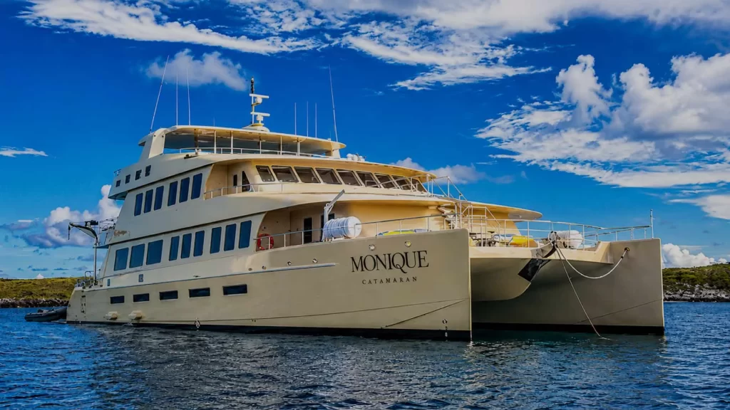
M/C Monique
A 2026 hybrid catamaran for 16 guests, with ocean-view suites, an open-air jacuzzi and a near one-to-one crew.
From USD 7,500
View yacht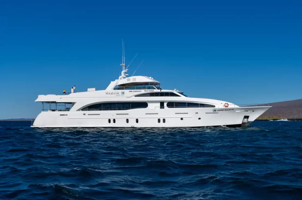
M/Y Grand Majestic
A 39-metre US-designed luxury motor yacht, launched in 2018 and reaching 25 knots, with a 39 m² master suite, seven staterooms and…
Private charter On request
View yacht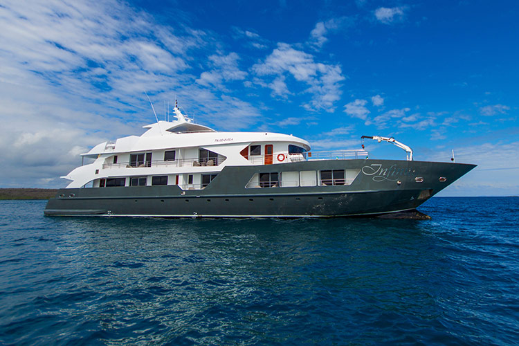
M/Y Infinity Expedition
A 49-metre luxury motor yacht launched in 2018, with eight double cabins and two suites, all with private balconies, a jacuzzi and…
Private charter On request
View yachtPersonal advice
Not sure which islands to choose?
Tell us what you would most like to see and we will match it with the yachts and routes that reach it on your dates.